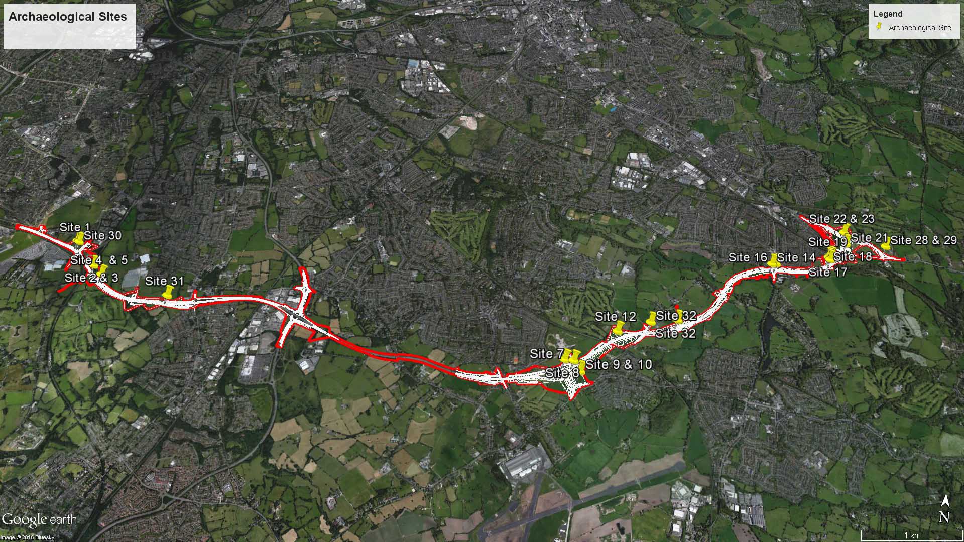
During the construction of the A6 to Manchester Airport Relief Road (A6MARR), a team of archaeologists are working to ensure that any potential archaeological findings during the works are accurately identified and recorded. Findings to date include an Iron Age roundhouse, a Roman road and Post Medieval field system.
Summarised below are the sites where archaeological works have been carried out with a summary of findings to date.
- Site 1, Styal Road (Moss Nook): Archaeological trench to target a former structure shown on the 1839 OS map. Here we located and recorded the foundations of the former structure (likely domestic), 18th-19th century in date.
- Sites 2-5, Styal: Archaeological strip and map targeting former township boundary and cropmarks. The archaeological works identified the remains of the main boundary ditch and associated post-medieval field system. Several isolated pits where also identified of uncertain date.
- Site 9-10, Bramhall Oil Terminal: targeting part of a Roman road. Earlier phases of excavation have identified the Roman road and an earlier Iron Age settlement. Further excavation work in this area has identified evidence of the post-medieval field system.
- Site 11, Bramhall Oil Terminal: Archaeological trench to target a position of a former building depicted in the location from 1770 to 1872, fronting Chester Road, known as ‘Bowerstump’. The rear foundations of this structure were located and recorded, and appeared domestic in function.
- Site 14, Norbury, Macclesfield Road: Palaeoenvironmental Sampling and watching brief at the location of the former settlement of Norbury (on-going during works within the area). Here we located several prehistoric ditches with some flint recovered, as well as post-medieval ditches and a moat relating to Norbury Hall. In addition a large pond-like feature with the remains of a cremated cow were uncovered. Recent excavations have uncovered structures to the south of the toll house (Site 16) previously identified. A culvert and other drainage features situated close to the bridge have been identified.
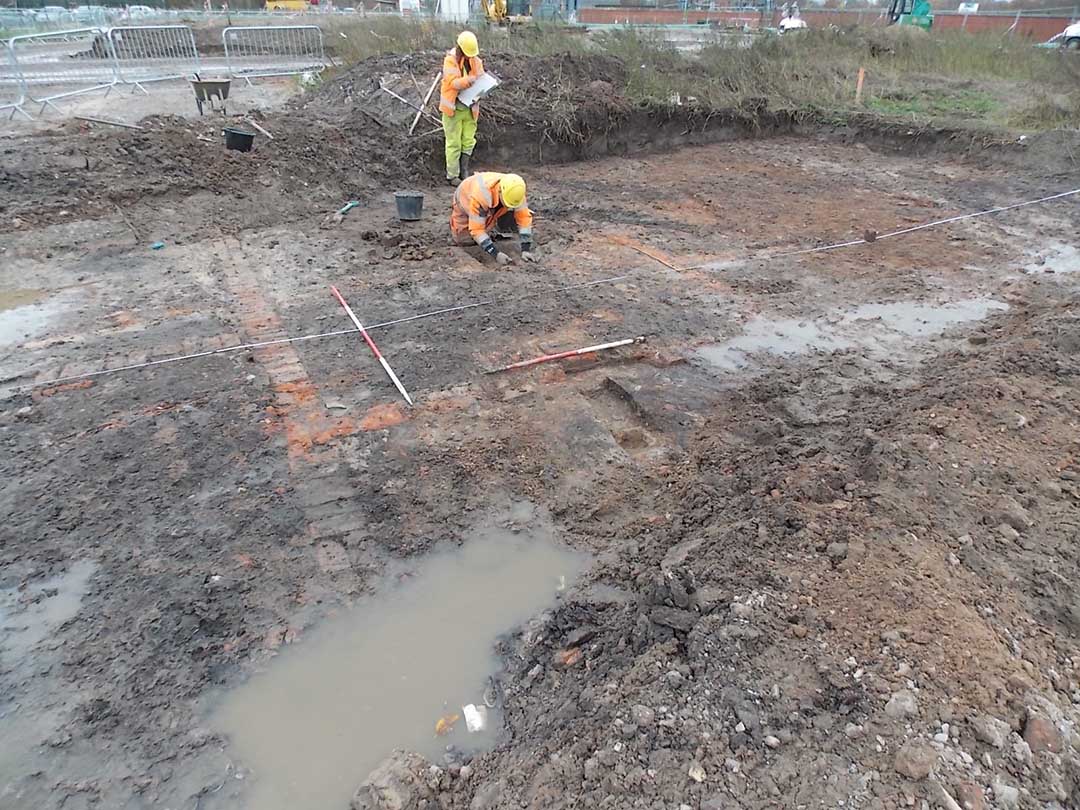
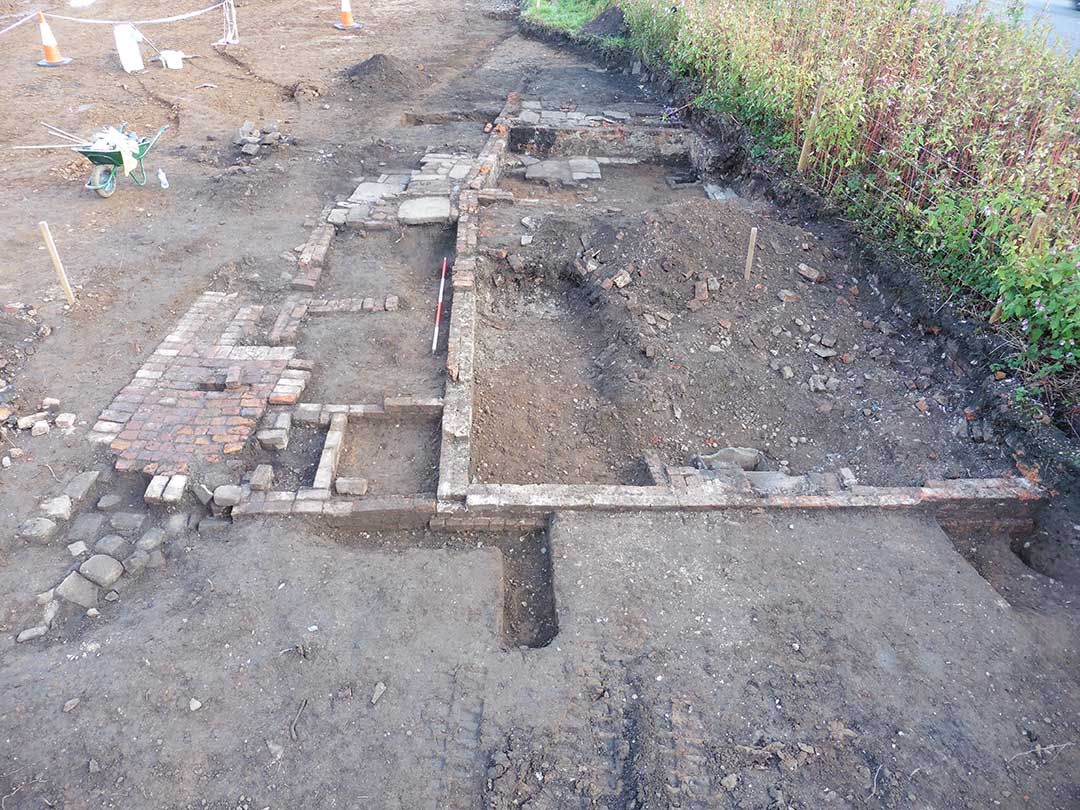
- Site 16, Norbury, Macclesfield Road: Archaeological Trench to target the former position of Norbury Toll House which had fronted Macclesfield Road and was depicted as two buildings on the 1850 Tithe map. The rear of the toll house, yard and outbuildings were uncovered and recorded.
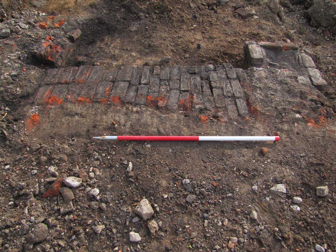
- Site 18-19, Norbury Mill: Watching brief during any groundworks within the vicinity of the former 18th-century Norbury Mill. The mill site was previously archaeologically excavated during the 1990s. this watching brief will document which areas are removed by the works and identify any archaeological features previously obscured. This watching brief has identified structural remains associated with the mill as well as timbers. Possibly for footings and a horse-gin wheel.
- Site 21, Buxton Road: A watching brief is being maintained during works along the road which may be a Roman road.
- Sites 22/23, Buxton Road: Evaluation trenches across an area of land which had previously undergone a programme of geophysical survey. The results of the survey were tested by three evaluation trenches which located only post-medieval field ditches.
- Site 25, Norbury Mill leat: Two trenches were excavated across the former Norbury Mill leat in order to characterise the leat’s built form. The two trenches revealed that the leat was a simple channel with earth banks built each side. There were no clay linings or structural forms evident. The leat changes form at junction of the head race with the mill itself, where the leat is constructed of large ashlar stone blocks.
- Site 30, Styal Road: Watching brief in an area of prehistoric wetland. These works are on-going but have not yet uncovered any archaeology.
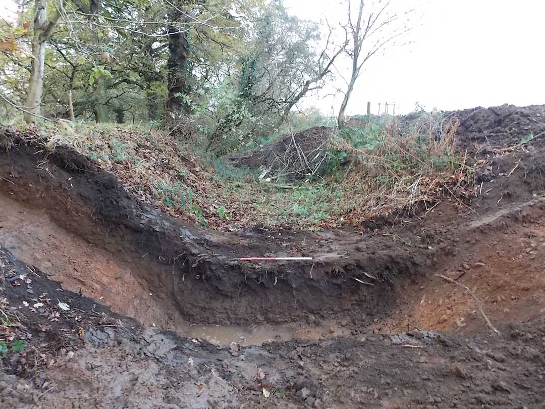
- Site 31, Off Clay Lane: Areas of ancient field system. Two trenches were excavated to investigate this area, which were subsequently enlarged to a 20m by 20m excavation area. Several shallow pits of uncertain age and a water channel were identified.
We will continue to update the website with any additional findings.
Archaeology Sites
Site 1
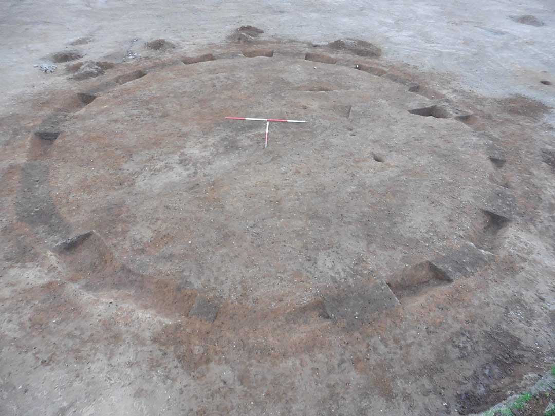
Site 9 and 10 – Iron Age Round House
Site 16
Site 18 structures